
Our 30th annual Dunbar/Spring Neighborhood Rain, Tree, & Food Forest Planting extended into the adjoining West University Neighborhood for a seventh year here in Tucson, Arizona.
But as both neighborhoods are part of, and share, the same watershed, you could say we planted in just one waterhood.
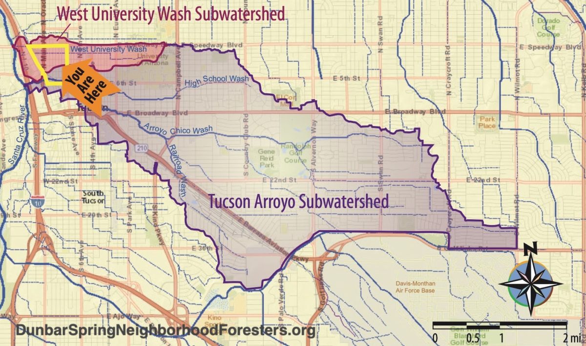
The Dunbar/Spring Neighborhood is marked by the yellow border, but the two subwatersheds that drain through our neighborhood contain many other neighborhoods.
We are all one “waterhood”.
In total, during our 2026 planting, we planted:
• Over 110,000 gallons (416,000 liters) of stormwater (that will be captured in the constructed street-stormwater-harvesting earthworks in an average year of rain).
(This water used to wastefully drain out of the neighborhoods, dehydrating them and creating downstream flooding).
We plant the rain before we plant any plants, so after establishment, passively-harvested rainwater and stormwater will be the sole irrigation source of the plantings post establishment. It takes one to three years of supplemental irrigation to get the plants established so they can then subsist on passively harvested rain and runoff alone.
• 24 native food-bearing trees that will grow to full size.
• 26 bush trees (see here for an example)
• 138 native, multi-use understory plants
• 1 adolescent saguaro
• Quarter pound of Wildlands Restoration’s native wildflower seed mix; and Bosque del Bac Restoration seed mix, sown along with neighborhood-grown coyote gourd seed and datura seed.
• Innovated with new basin bank stabilizing materials of salvaged storm-damaged hardwood logs and salvaged urbanite (broken up chunks of old concrete sidewalk).
Volunteers who helped plant:
Over 40
Neighborhoods represented by the volunteers that helped plant:
8
Neighborhood blocks of public pedestrian paths cleared of gravel/rock, pruned, and widened to five feet—to regain full pedestrian access:
1.5
Six-inch, five-inch, and four-inch diameter curb cores made to direct street runoff into street-side basins:
14
Existing driveway dips in street curb used as street-side basin inlets:
2

Brad Lancaster of Neighborhood Foresters creates these plans for every site.

Blue arrows denote stormwater flow.
We call 811 (a free service) to mark all underground utilities before proceeding with design and construction.
Yellow spray paint on ground denotes underground gas line location.
Photo: Brad Lancaster

Photo: Brad Lancaster

We primarily plant seed and 1-gallon-size plants.
Smaller plants are cheaper, grow quicker & get established quicker than larger plants, and easier to plant as you dig smaller holes.
Though we do plant 5-gallon-size trees, and 5-gallon-size plants in the bottom of the basins, so the tops of the plants are above the water line in their first year in the basins.
Photo: Brad Lancaster

Blue arrows denote stormwater flow.
Subtle rolling dips direct stormwater off the earthen foot path and into the basins.
Note the 3-foot (1-meter) wide pedestrian platforms between street curb and basins, which creates a nice level surface passengers can step out onto when exiting cars parked on the street beside the basins.
Rock work and log work by Dryland Design.
Photo: Brad Lancaster

Blue arrows denote stormwater flow.
Rock work and log work by Dryland Design.
Photo: Brad Lancaster.

The logs are superior wildlife habitat compared to rock, and they don’t need to be purchased or transported into the neighborhood – they are already here for free!
Rock work and log work by Dryland Design.
Photo: Brad Lancaster

Note in right hand side of image, at downstream side of basin where chance of erosion is the lowest, we sloped the bank more gradually to do away with the need for, and cost of, rock there.
We are always evolving to reduce costs, increase effectiveness, consume less, and regenerate more sustainable life.
Rock work and log work by Dryland Design.
Photo: Brad Lancaster
Organizing, community outreach, permitting, and coordination
Dunbar/Spring Neighborhood Foresters
Design & plant selection
• Brad Lancaster of Rainwater Harvesting for Drylands and Beyond
Contractors we collaborated with to create the earthworks pre-planting, rockwork, and the curb core holes post-planting:
• Little John Excavating
• Dryland Design
• Tucson Concrete Cutting
Multi-use Tucson Basin native plants we plant
Local plant nurseries from which we sourced the plant material:
• Nighthawk Natives Nursery
• Spadefoot Nursery
• Wildlands Restoration
• Desert Survivors Native Plant Nursery
Local company from which we sourced the Catalina granite to line the basin banks
• Churchman Sand & Gravel

Blue arrows denotes stormwater flow.
Photo: Brad Lancaster
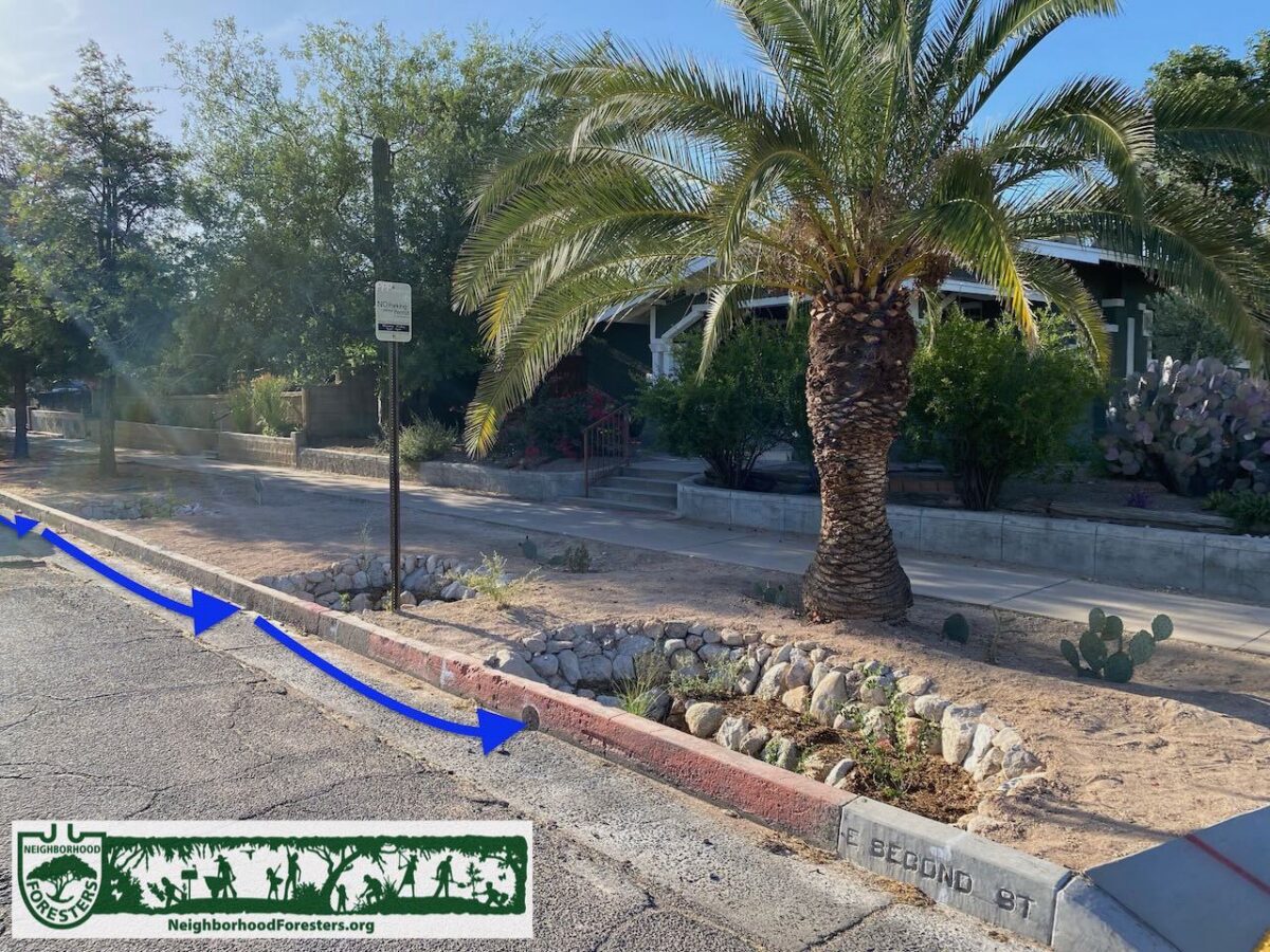
These basins are closer to street curb, and do NOT have a pedestrian platform against the curb as there was not enough room for the basins and pedestrian platforms due to an underground water line that runs parallel with the street (between palm tree and the street-side basin).
No parking is allowed along street curb where it is painted red.
Blue arrow denotes stormwater flow.
Rock work by Dryland Design.
Photo: Brad Lancaster

Blue arrow denotes stormwater flow.
Photo: Brad Lancaster
Huge thanks to the many volunteers that helped plant out all these water-harvesting earthworks!
We couldn’t do it without you, and you all can now further spread these good practices and knowledge deeper throughout our community.
Why we plant with community volunteers
This directly connects the people to each other, the plants they are planting, and the land in which they are planting. It is the literal and metaphorical growing of roots, as they learn and practice rain-irrigated native food forestry.
This is enhanced when neighbors hand water the new plantings with a hand-held hose to get the plants established, as it further connects the people to the plants as they watch them grow, and they are out on the street talking to passers by, who when interested, can learn about the planting program and the neighborhood direct from their neighbor.

Blue arrows denote water flow.
We call 811 (a free service) to mark all underground utilities before proceeding with design and construction.
Pink spray paint on ground denotes where basins will go.
Yellow spray paint on ground denotes underground gas line.
Blue spray paint on ground denotes underground water line.
Photo: Brad Lancaster

Blue arrows denote stormwater flow.
Cart in street is the fiesta cart with free beverages and snacks for the planters provided by neighbor Jim Glock.
Rock work by Dryland Design.
Photo: Brad Lancaster
Spread the word for next year
If you live within this waterhood share this with you neighbors, as we are NOW taking orders for the 2027 plantings. Check our Events page and Blog later this year for updates. Or better yet, sign up on our Contact page.
And if you live in this or a different waterhood, consider starting up a neighborhood forester effort in your neighborhood (we can help you).

Blue arrows denote water flow.
Pink lines denote basins to be excavated.
Yellow lines denote underground gas line.
Photo: Brad Lancaster
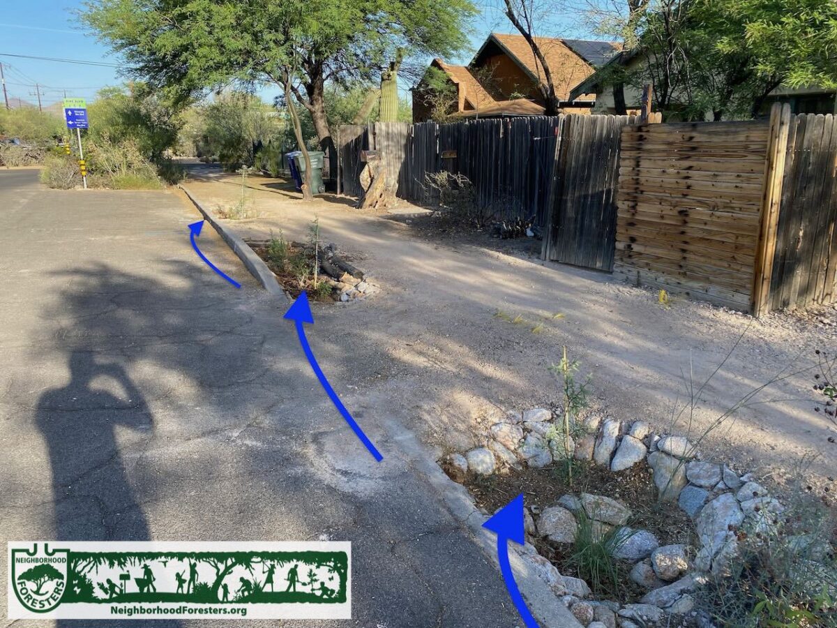
Blue arrows denote water flow.
These basins could not be made any wider due to underground gas line running parallel with the street under the earthen footpath.
Photo: Brad Lancaster

Photo: Brad Lancaster

A waste turned into a resource, without any fossil fuel consumption to transport the material.
The rough underside of the sidewalk pieces was placed to face outward, giving the urbanite a rougher and more natural appearance.
I find urbanite can be installed more quickly than rock.
Photo: Brad Lancaster
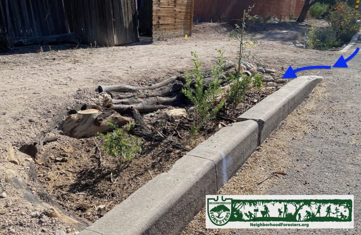
The logs are superior wildlife habitat compared to rock, and they don’t need to be purchased or transported into the neighborhood – they are already here for free!
We have found the hardwood logs (mostly mesquite) have over a 20-year lifespan as bank stabilization.
Photo: Brad Lancaster
Water-harvesting books & website for more info:
Rainwater Harvesting for Drylands and Beyond, Volume 1 and Volume 2

Pink spray paint on ground denotes basins to be excavated.
Yellow spray paint on ground denotes underground gas line location.
Blue arrows denote stormwater flow.
Photo: Brad Lancaster
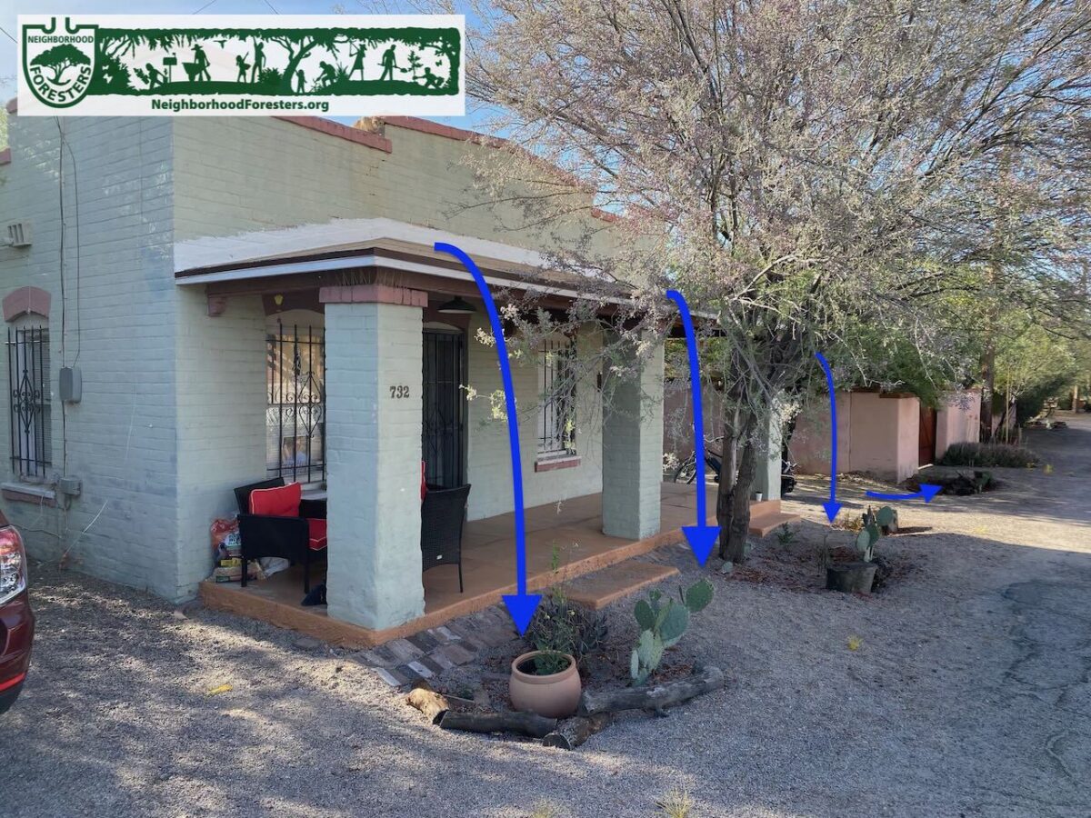
Blue arrows denote stormwater flow.
Basin size was limited due to potential conflict with underground utilities.
Photo: Brad Lancaster
Breakdown of the 2026 planting numbers by neighborhood:
Dunbar/Spring Neighborhood
Planted:
• Over 10,000 gallons of stormwater per year
• 5 native trees that will grow to full size
• 6 native bush trees
• 22 native understory plants
• 1 curb cores (plus, one driveway dip in curb was used instead of a curb core) to direct street runoff into street-side rain gardens
• 8 volunteers helped plant
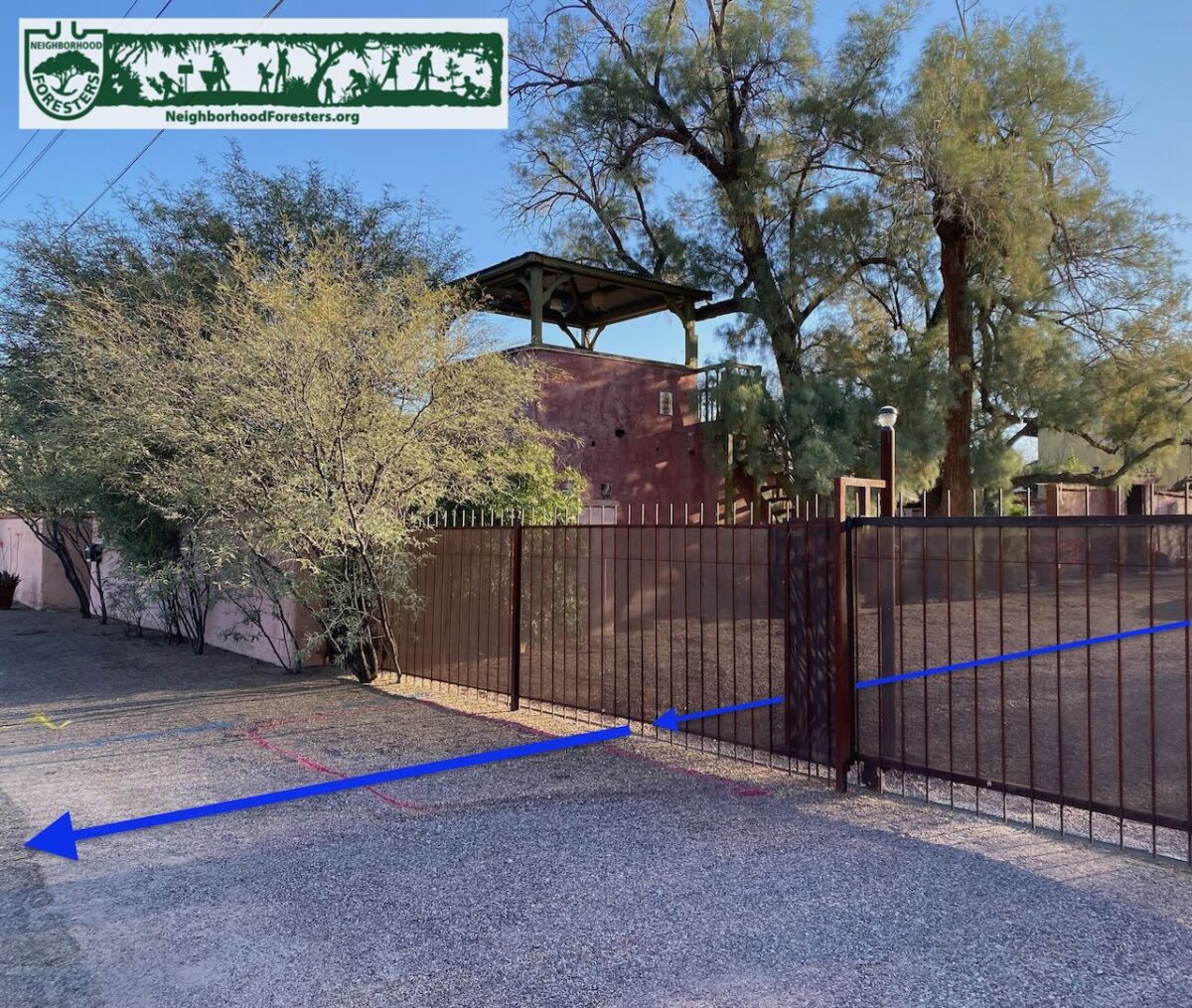
Blue arrows denote stormwater flow.
Photo: Brad Lancaster
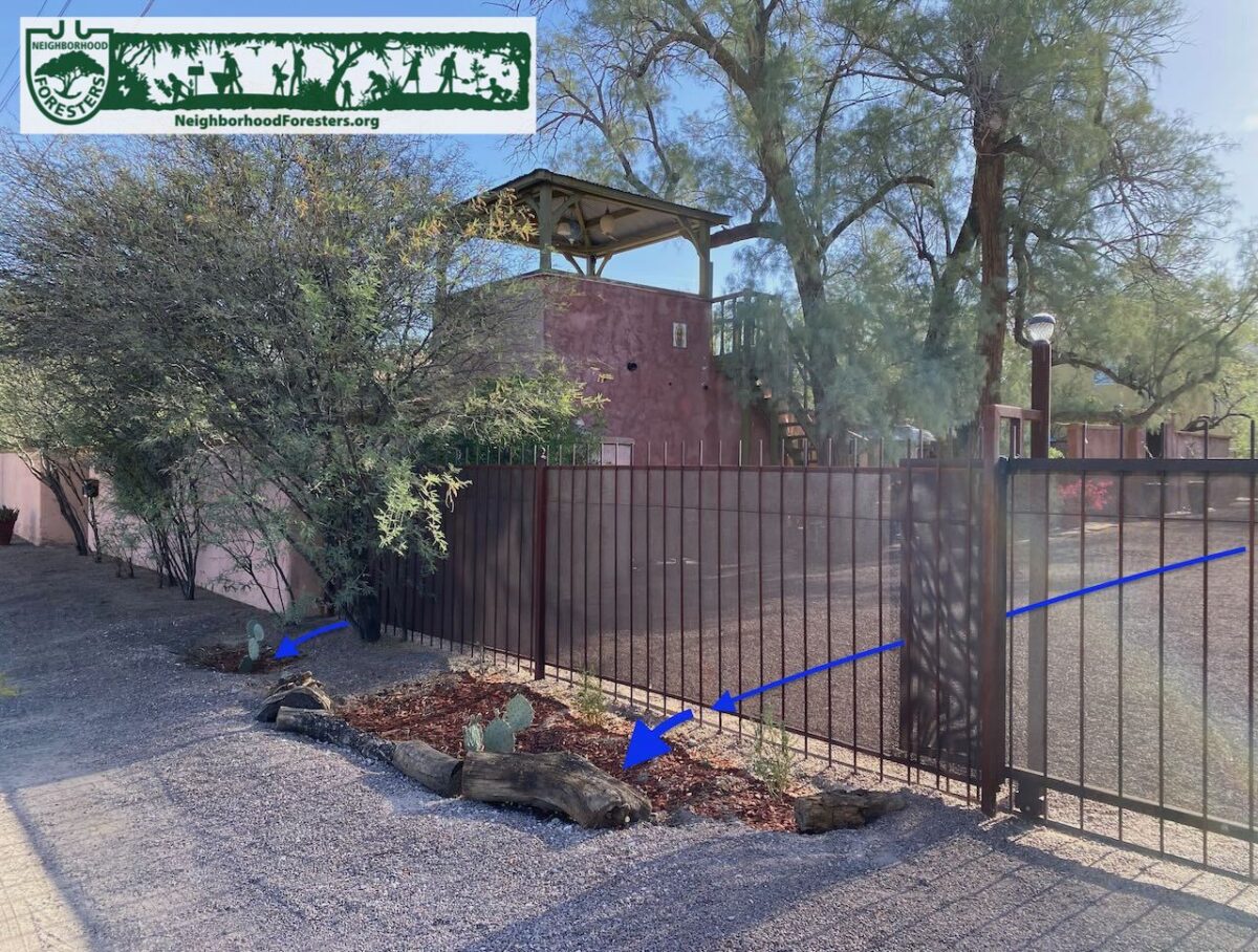
Blue arrows denote stormwater flow.
Photo: Brad Lancaster
West University Neighborhood
Planted:
• Over 100,000 gallons of stormwater per year
• 19 native trees that will grow to full size
• 20 native bush trees
• 116 native understory plants
• 13 curb cores drilled to direct street runoff into street-side rain gardens
• 40 volunteers helped plant

Blue arrows denote stormwater flow.
Photo: Brad Lancaster

Blue arrows denote stormwater flow.
Rock work by Dryland Design.
Form work to the side is for a sidewalk being installed by the city.
Photo: Brad Lancaster
Please consider making a donation
to the Dunbar Spring
Neighborhood Foresters
so we can continue and grow these efforts, share lessons learned, and provide the organizational tools we continue to evolve to everyone:
DONATE HERE

To see plantings from other years:
Annual rain & native food forest plantings another success in 2025
Annual rain & native food forest plantings another success in 2024
Annual rain & native food forest plantings another success in 2023
Annual rain & native food forest plantings another success in 2022
Annual rain & native food forest plantings another success in 2021
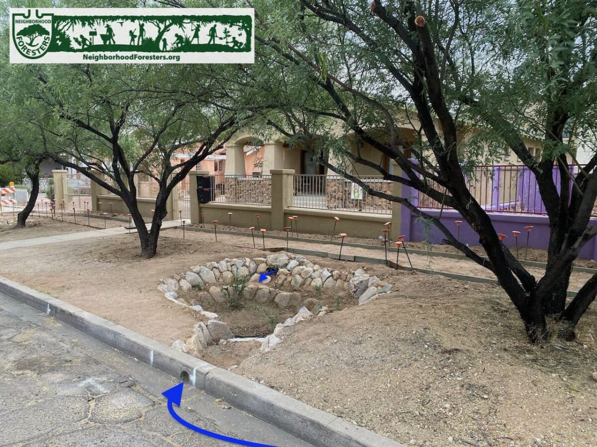
Note two water sources:
1. Stormwater from street.
2. Stormwater from yard drained to street-side basin via two black 4-inch diameter pipes that used to drain the water to the street.
Formwork in the background is for a sidewalk the city is installing.
Photo: Brad Lancaster

Photo: Brad Lancaster