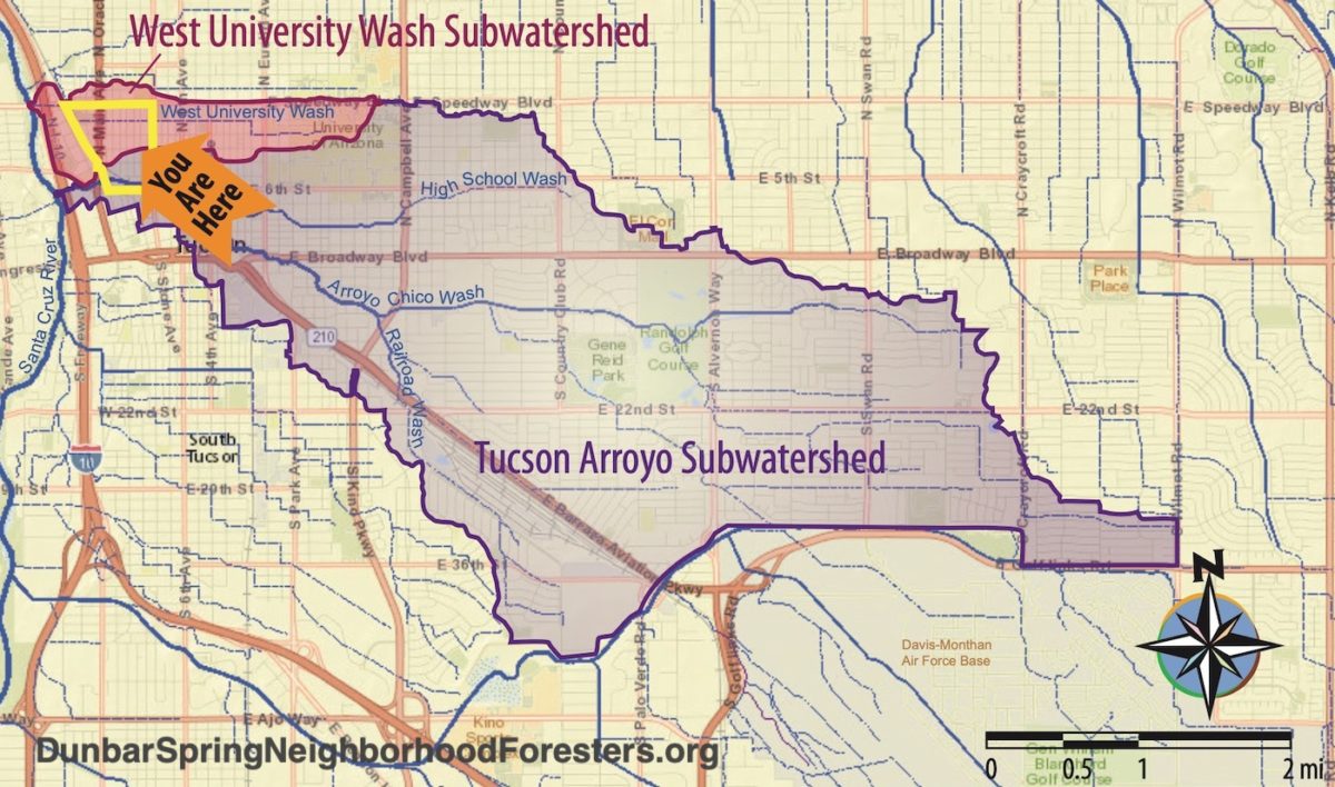
Our 29th annual Dunbar/Spring Neighborhood Rain, Tree, & Food Forest Planting extended into the adjoining West University Neighborhood for a sixth year here in Tucson, Arizona.
But as both neighborhoods are part of, and share, the same watershed, you could say we planted in just one waterhood.
In total, during our 2025 planting, we planted:
• Over 110,000 gallons of stormwater (that will be captured in the constructed street-stormwater-harvesting earthworks in an average year of rain).
(This water used to wastefully drain out of the neighborhoods, dehydrating them and creating downstream flooding).
We plant the rain before we plant any plants, so after establishment, passively-harvested rainwater and stormwater will be the sole irrigation source of the plantings post establishment. It takes one to three years of supplemental irrigation to get the plants established so they can then subsist on passively harvested rain and runoff alone.
• 22 native food-bearing trees that will grow to full size.
• 33 bush trees (see here for an example)
• 188 native, multi-use understory plants
• 1 adolescent saguaro
• Quarter pound of Wildlands Restoration’s native wildflower seed mix; and Bosque del Bac Restoration seed mix, sown along with neighborhood-grown coyote gourd seed and datura seed.
Volunteers who helped plant:
54
Neighborhoods represented by the volunteers that helped plant:
8
Neighborhood blocks of public pedestrian paths cleared of gravel/rock, pruned, and widened to five feet—to regain full pedestrian access:
4
Four-inch diameter curb cores made to direct street runoff into street-side basins:
20
Existing driveway dips in street curb used as street-side basin inlets:
1

Brad Lancaster of Neighborhood Foresters creates these plans for every site.

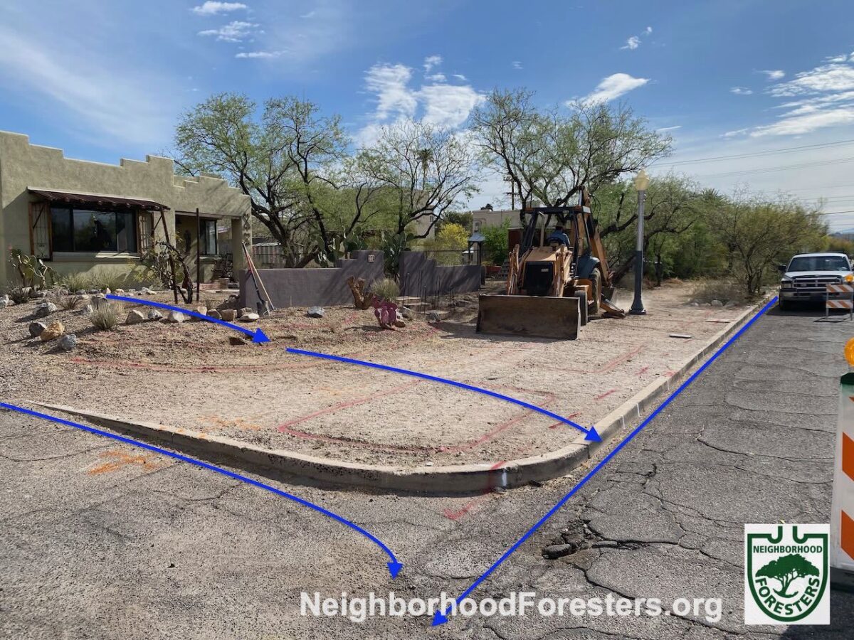
Backhoe is leveling the minimum 5′-wide public path to enhance the pedestrian experience.
(The front yard’s slope and gravel had been eroding into the path for years).
Little John Excavating doing the work. Next John will dig the basins. Excavated dirt is hauled away in the trucks that deliver the rock to stabilize the basin banks. This saves money and diesel.
Pink lines in dirt denote where the backhoe operator is to dig to create the water-harvesting basins.
Red markings denote underground electric and fiber optic lines.
All sites are bluestaked (have all their underground utilities marked – a free service accessed by calling 811) BEFORE the designs and work are done to avoid any conflicts.
Blue arrow denotes stormwater flow in street gutter.
Photo: Brad Lancaster

After the backhoe excavates the basins, they are hand shaped by the crew from Dryland Design. Caliche hardpan is hauled away. Gabrielle is separating the big caliche chunks with a pitchfork, and removing them from the basin.
Photo: Brad Lancaster

Neighborhood Foresters selects and delivers the Tucson Basin native plants for the basins. Plants are placed in their ideal rain garden planting zone in the exact spot where they are to be planted before volunteer planters arrive.
Photo: Brad Lancaster

Prior to planting Neighborhood Foresters give a quick planting demonstration, then they supervise the planting.
Blue arrows denote water flow.
Turquoise circles denote where curb cores will go.
Photo: Brad Lancaster

Blue arrows denote new, functional water flow.
4″-diameter curb cores have been drilled in the street curb to direct street runoff to street-side backwater or eddy basins for free irrigation.
The new plantings are given supplemental irrigation for the first one to three years to get them established, then are only watered with the freely harvested rainfall and stormwater runoff after that.
Photo: Brad Lancaster

Photo: Brad Lancaster
Blue arrows denote the dysfunctional water flow, whereby the bulk of the rainfall (along with soil) runs off the site into the street.
Pink lines in dirt denote where the backhoe operator is to dig to create the water-harvesting basins.
Red and orange markings denote underground electric and fiber optic lines.
All sites are bluestaked (have all their underground utilities marked – a free service accessed by calling 811) BEFORE the designs and work are done to avoid any conflicts.
A minimum 5′-width is maintained for the public pathway, so people can comfortably walk side by side.
Photo: Brad Lancaster

Blue arrows denote the new functional water flow that harvests and infiltrates the rain and stormwater runoff for free irrigation and rehydrating our watershed.
Dryland Design did the master rock work using local Catalina granite. Rock is ONLY used to stablize basin banks and terrace walls. NO rock is used in basin bottoms, as rock would impede water infiltration.
Organic compost mulch from neighborhood goat pen is used on basin planting terraces and basin bottoms.
NO gravel is used on pathways, instead we use native soil. This is cheaper and far more accessible for the very young, the elderly, and those on wheels.
Photo: Brad Lancaster
Organizing, community outreach, permitting, and coordination
Dunbar/Spring Neighborhood Foresters
Design & plant selection
• Brad Lancaster of Rainwater Harvesting for Drylands and Beyond
Contractors we collaborated with to create the earthworks pre-planting, rockwork, and the curb core holes post-planting:
• Little John Excavating
• Dryland Design
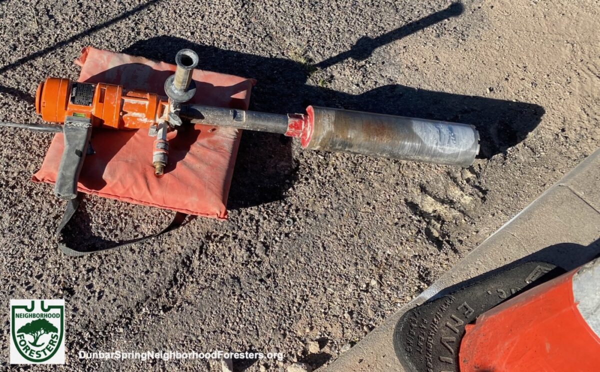
• Tucson Concrete Cutting
Local plant nurseries from which we sourced the plant material:
• Desert Survivors Native Plant Nursery
• Nighthawk Natives Nursery
• Spadefoot Nursery
• Wildlands Restoration
Local company from which we sourced the Catalina granite to line the basin banks
• Churchman Sand & Gravel
Huge thanks to the many volunteers that helped plant out all these water-harvesting earthworks!
We couldn’t do it without you, and you all can now further spread these good practices and knowledge deeper throughout our community.
Why we plant with community volunteers
This directly connects the people to each other, the plants they are planting, and the land in which they are planting. It is the literal and metaphorical growing of roots, as they learn and practice rain-irrigated native food forestry.
This is enhanced when neighbors hand water the new plantings to get them established as it further connects them to the plants as they watch them grow, and they are out on the street talking to passers by, who when interested, can learn about the planting program and the neighborhood direct from their neighbor.

Blue arrows denote the dehydrating draining of stormwater flow.
NE corner of 2nd Street and 11th Avenue, Dunbar/Spring neighborhood.
Pink line delineates the water-harvesting basin boundary to be excavated (as do the white lines on the street curb— use chalk paint that will more quickly fade with time).
Red and yellow lines denote the underground electrical and gas lines marked by bluestake for free BEFORE we make our designs or do on the ground work.
Photo: Brad Lancaster

Photo: Brad Lancaster

Blue arrows denote new rehydrating retaining of stormwater flow that will be rapidly infiltrated into the soil and plants.
Photo: Brad Lancaster
Spread the word for next year
If you live within this waterhood share this with you neighbors, as we are NOW taking orders for the 2025 plantings with sign up deadline of October 8, 2025. Check our Events page and Blog later this year for updates. Or better yet, sign up on our Contact page.
And if you live in this or a different waterhood, consider starting up a neighborhood forester effort in your neighborhood (we can help you).

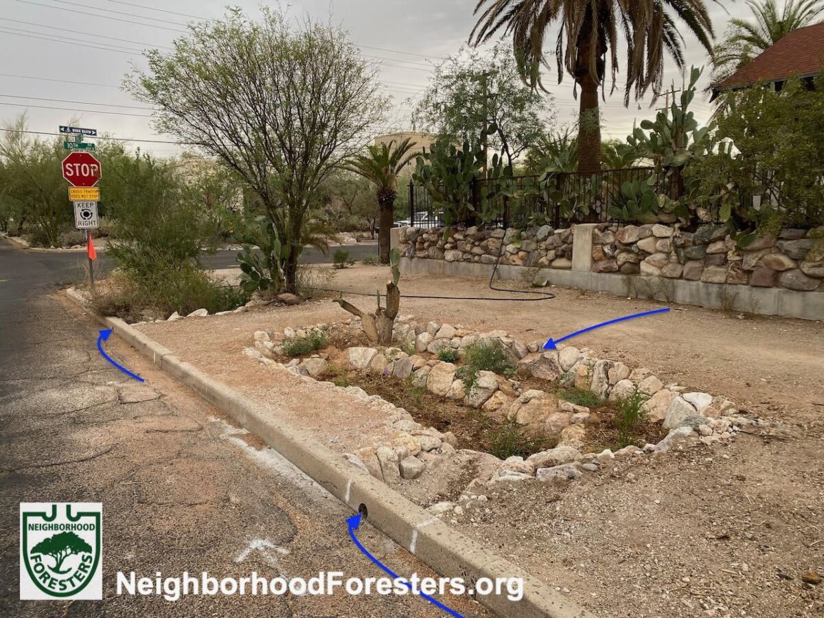
NE corner of 10th Ave and 2nd Street, Dunbar/Spring neighborhood.
When caliche is this bad, we need to bring in soil to replace the hardpan removed.
Stumps of dead palm trees and a suffering palm tree were also removed.
Blue arrow denotes stormwater flow in street gutter.
Photo: Brad Lancaster

Hose water is being used to water the newly planted vegetation. Such supplemental watering is done for the first one to three years to get the native plantings established. After that they are watered solely by the passively harvested rainfall and stormwater runoff.
Photo: Brad Lancaster
Blue arrow denote new rehydrating water flow. Stormwater from street gutter is directed to street-side basins via 4-inch diameter curb cores. Public pathway runoff is directed to path-side basin.
Photo: Brad Lancaster
Water harvesting books & website for more info:
Rainwater Harvesting for Drylands and Beyond, Volume 1 and Volume 2

Stormwater from the street gutter is directed into the basin via an existing driveway dip in the curb.
Blue arrows denote stormwater flow.
Along the wall, small boomerang berms keep rainfall around the native edible cacti, instead of allowing it to wastefully drain into the public pathway.
University Blvd in Dunbar/Spring neighborhood.
Photo: Brad Lancaster
Breakdown of the 2025 planting numbers by neighborhood:
Dunbar/Spring Neighborhood
Planted:
• Over 30,000 gallons of stormwater per year
• 8 trees that will grow to full size
• 80 understory plants
• 7 curb cores (plus, one driveway dip in curb was used instead of a curb core) to direct street runoff into street-side rain gardens
• 22 volunteers helped plant

Blue arrows denote stormwater flow.
The main flow is in the street gutter, but in big storm events at this site water also flows over the street curb and down the public right-of-way. As a result, at this site we created hybridized eddy basins that are ALSO flow-through basins (usually an eddy basin is NOT a flow through basin).
Photo: Google Maps street view.

Rock mulch rundowns are used on the inlet side of every basin. See chapter 10 of the full-color edition of Rainwater Harvesting for Drylands and Beyond, Volume 2 for how to design, place, hybridize, and construct rock mulch rundowns and other in-channel structures.
Photo: Brad Lancaster

Planting pots are returned to the plant nurseries so they can be reused.
Photo: Brad Lancaster

Photo: Brad Lancaster

Blue arrows denote stormwater flow. Most of the stormwater is captured via 4″-diameter cores in the street curb, but in big flow events stormwater overtops the curb and flows down the public right-of-way between sidewalk and street curb.
So, gradual U-shaped rock mulch rundown/one-rock dam hybrids are placed on the upstream side of every basin to direct stormwater into the basins while protecting side walk and street curb.
These structures also act as a form of grade-control, preventing erosive downcutting. Each basin overflows to the next basin downstream.
Photo: Brad Lancaster
West University Neighborhood
Planted:
• Over 80,000 gallons of stormwater per year
• 14 trees that will grow to full size
• 141 understory plants
• 13 curb cores drilled to direct street runoff into street-side rain gardens
• 31 volunteers helped plant

Brad Lancaster of Neighborhood Foresters creates these plans for every site.

Blue arrows denote stormwater flow.
The main flow is in the street gutter, but in big storm events at this site water also flows over the street curb and down the public right-of-way.
NOTE the loose soil that had recently been applied by a neighbor to fill in the gully that had formed beside the street curb (this would have just washed downstream in the next big storm event).
As a result, at this site we chose to create hybridized eddy basins that are ALSO flow-through basins (usually an eddy basin is NOT a flow through basin), which double as grade-control structures.
Photo: Brad Lancaster

Excavated dirt is hauled away in the trucks that deliver the rock to stabilize the basin banks. This saves money and diesel. The backhoe then distributes the delivered rock (in background of this photo) to each basin.
Photo: Brad Lancaster

Photo: Brad Lancaster

NO rock is placed in basin bottom or planting terraces, because that would reduce water infiltration.
Photo: Brad Lancaster

At the very western end a rock baffle was installed to redirect stormwater to the street and protect the above ground utility boxes in the public right-of-way.
Photo: Brad Lancaster

Photo: Brad Lancaster

Photo: Brad Lancaster

Blue arrows denote stormwater flow.
Most of the stormwater is captured via 4″-diameter cores in the street curb, but in big flow events stormwater overtops the curb and flows down the public right-of-way between sidewalk and street curb.
So, gradual U-shaped rock mulch rundown/one-rock dam hybrids are placed on the upstream side of every basin to direct stormwater into the basins while protecting side walk and street curb.
These structures also act as a form of grade-control, preventing erosive downcutting. Each basin overflows to the next basin downstream.
Photo: Brad Lancaster
Please consider making a donation
to the Dunbar Spring
Neighborhood Foresters
so we can continue and grow these efforts, share lessons learned, and provide the organizational tools we continue to evolve to everyone:

Blue arrow denotes stormwater flow.
Photo: Brad Lancaster

Blue arrow denotes stormwater flow from street gutter to basin via 4′ diameter street curb core, and flow from adjoining pathways.
Photo: Brad Lancaster

Blue arrow denotes stormwater flow.
Photo: Brad Lancaster

Blue arrow denotes stormwater flow.
Photo: Brad Lancaster
To see plantings from other years:
Annual rain & native food forest plantings another success in 2024
Annual rain & native food forest plantings another success in 2023
Annual rain & native food forest plantings another success in 2022
Annual rain & native food forest plantings another success in 2021

NW corner of 2nd Street and 3rd Avenue in West University neighborhood.
Blue arrows denote stormwater flow.
Red lines denote underground street light electrical line.
Pink line denotes water-harvesting basin boundary.
The non-native South-american hybrid mesquite tree on left was diseased and root bound, thus it was removed and replaced with a 5-gallon-size native velvet mesquite tree that will soon grow big.
Photo: Brad Lancaster

Photo: Brad Lancaster

Blue arrows denote stormwater flow.
Photo: Brad Lancaster

SE corner of 2nd Avenue and 2nd Street in West University neighborhood.

Photo: Brad Lancaster

Blue arrows denote water flow.
Photo: Brad Lancaster