Check out the map above created by Julius Scholsburg to see for yourself.
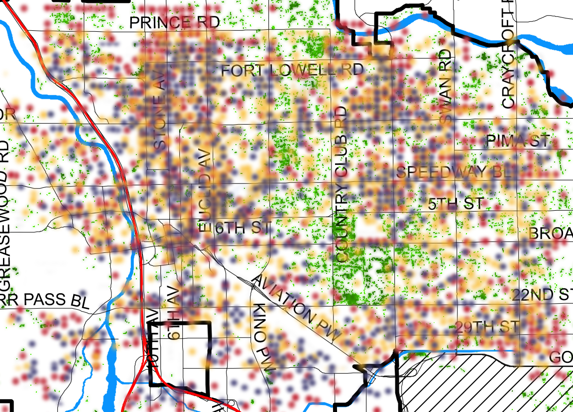
The map above is a tree cover map of Tucson, Arizona with crime report data overlaid. Where there are more trees, there are fewer crimes. Where there are less trees, there are more crimes.
The base layer (tree cover) of the map is from this tree cover map from the 2011 Tucson General Plan.
The crime data is from CityProtect. Julius took screenshots of the crime maps of different categories of crimes (with data going back ten years), isolated the colored dots in photoshop, then lined up the streets with the tree map and blended the two.
The idea to make the map was inspired by this study of the phenomenon in Baltimore.
For more maps that enable us to see and act in new ways check out:
• Using free online PAG mapping tool to see tree canopy, water flow, and more in your neighborhood